Kamniški vrh (1259 m)
© Mateja Gruden
© Mateja Gruden

© Mateja Gruden

© Mateja Gruden

© Mateja Gruden
Enjoy sweeping views from the slopes of this popular mountain on the edge of the Alps – but only for experienced hikers
This is a beautiful loop route offering splendid panoramas, suitable only for seasoned mountaineers accustomed to steep and exposed routes. Although the summit does not rise above the tree line, sections of the trail have a distinct high-mountain character. For this reason, good hiking boots and trekking poles are essential. This is a hike rich in spectacular views and vibrant colours from spring through autumn.
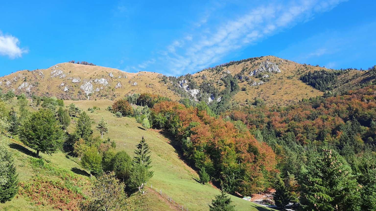
The landscape shows you many faces: grassy meadows and pastures, scree slopes tumbling steeply down hillsides, dense forests that barely let in any sunlight, rugged and exposed rock formations and ravines, lush alpine vegetation, and mountain wildflowers.
The trail to Kamniški vrh begins by the Bistričica stream in the village of Klemenčevo, where there is a gravel parking area. Here, you’ll also spot a wooden sign marked “Kamniški vrh” representing the trailhead. Arrows lead you twice across the shallow stream bed before you ascend along a wide forest cart track (always keep to the right-hand path at junctions). Soon you reach a grassy pasture slope. A well-worn narrow path takes you across it, offering your first views of the surrounding hills. After a short climb, you come to a fence and a forest cart track.
Cross the track and climb wooden steps straight onto a gravelly, increasingly steep path that ascends along the edge of the Ravne Senožeti mountain pasture. You can see the summit ridge along the forest edge above you, where you’ll later walk.
After a while, you arrive at a new wooden fence and steps. There’s a fork at this point: the left path leads to the summit via a challenging, very steep, and scree-covered route – especially difficult going down due to the risk of slipping. The path straight ahead takes you into the forest. At first, this trail is pleasant with a moderate ascent, crossing two scree slopes (take care!), until you emerge from the woods onto the steep, grassy, and very scenic slope of Kamniški vrh. Continue straight on (a steep path branches off to the left) along a narrow but good and fairly level track.
The crossing ends at the edge of the slope with a bench. Follow the path left, uphill on a scree trail, to mountain trail signposts where a marked hiking route from Županje Njive and Stahovica joins. The mountain trail signpost for Kamniški vrh points left on a gentler but very narrow path that soon crosses a steep grassy slope. You continue straight ahead. The steepness does not let up, and the path remains gravelly and rocky. Extra caution is especially important here!
When this demanding climb ends, reward yourself with a scenic rest on the bench just before Kamniški vrh. The peak itself is “hidden” in the forest, marked only by a summit register box.
Descent
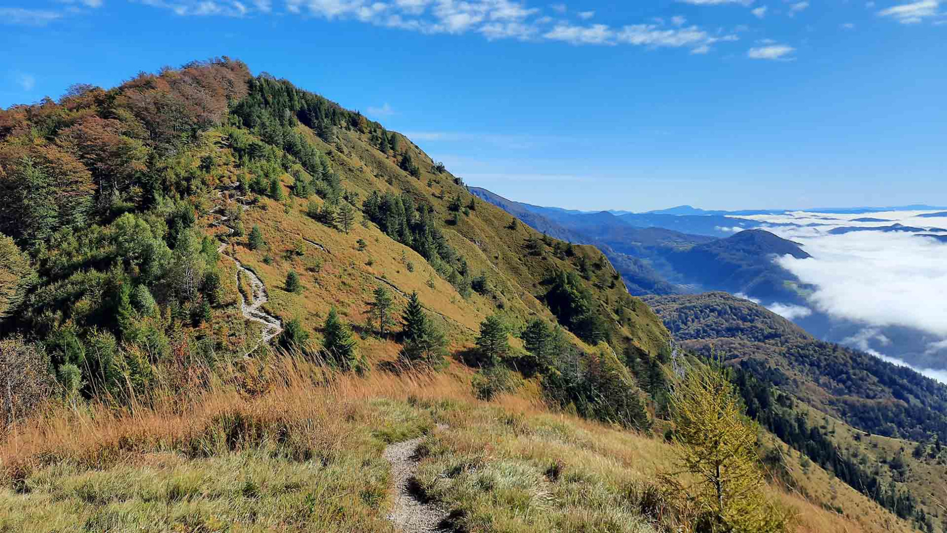
From Kamniški vrh, descend to the saddle by following the mountain trail signposts. Continue along the trail to the Osredek mountain pasture, which leads you after another climb to the neighbouring Planjava peak (1,243 m). On clear days, glimpses through the tree canopy reveal the rock walls and summits of the Kamnik–Savinja Alps.
From Planjava, continue along a narrow ridge trail that undulates up and down. The trail is exposed in places and requires extra care, passing through open areas with panoramic views as well as wooded sections. Parallel to this ridge trail or below it, a signposted mountain path runs through the forest and is accessible by descending from the ridge. Both paths join in the forest at a fork where you take the left route.
From here, you mostly descend toward the trailhead. You first pass through forest before it thins out, where the trail sharply forks left toward wooden huts at Planina Osredek. Pass by the huts, initially on an easy path, but then the terrain becomes more rugged and alpine as you descend steeply across rocky ground. You descend over rocky terrain, and cross two gullies where the exposed sections are generally well made and secured with steel cables. Here, again, utmost caution is required!
Afterwards, the trail becomes easier as it leads through forest onto grassy pasture slopes. Soon you reach a wooden fence where you crossed the cart track on your ascent. From there, descend right along the ascent route back to the starting point.
Starting point
Klemenčevo (approx. 37 km from the centre of Ljubljana): macadam car park by the Bistričica stream at the point where the asphalt road ends. To get here, drive from Kamnik to Stahovica, then turn left in the direction of Županje Njive and follow the main road to the starting point.
Season
snow-free season
Food and drink
- Gostilna Repnik, Kamnik


