Šmarna gora: route via Spodnja Kuhinja (669 m)
© Matej Povše

© Matej Povše

© Matej Povše

© Matej Povše
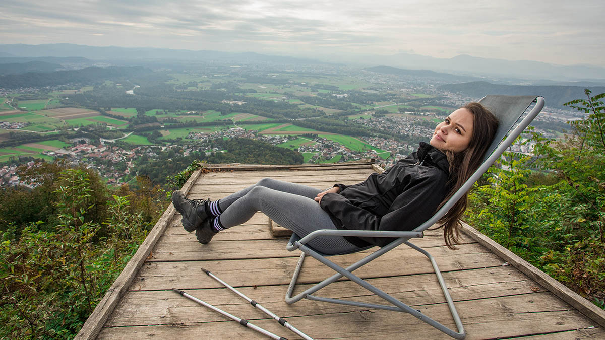
"The Roof of Ljubljana," the city’s favourite viewpoint
Anyone visiting Ljubljana who wants to feel like a local should climb Šmarna Gora (whose name in English means St Mary’s Mount). On fine days, particularly at weekends, this very popular hiking destination on the edge of Slovenia’s capital city can get quite crowded. In part (or above all) because of the fantastic view and the excellent gostilna (restaurant) at the summit.
It is well worth spending time here, especially on a clear day, to relax in the shelter of the little pilgrimage church and enjoy the view of Ljubljana with the river Sava, the surrounding hills and the Alps beyond. And also to indulge in a snack or lunch at Gostilna Ledinek, with a menu consisting of traditional Slovene dishes. Below the church is a children’s playground and an open-air fitness area. Before going back down the hill you can ring a bell for good luck – St Anthony’s Bell just below the summit is also known as the “wishing bell”.
A dozen routes lead up to Šmarna Gora from various starting points. We have chosen the route via Spodnja Kuhinja (“Pot čez Spodnjo Kuhinjo”) starting in Tacen, where there is a large car park (charges apply) and which can also be reached by bus. It is also known as the “Path over the Roots” – for reasons that will soon become apparent! This is the most popular route up Šmarna Gora, on which you will meet other hikers from early morning until late in the evening. The route is not exposed, but it is quite steep, with frequent tree roots on the path and some rocky sections.
From the parking area, where the first information board shows the network of trails crisscrossing Šmarna gora, set off towards the foot of the hill. At the second information board, begin the ascent into the forest. This is initially on a relatively steep and well-maintained path that then widens and flattens somewhat after the first climb. The trail then rises more steeply again for a while, up to a hillside crossing, where the path gently ascends to a fork, joining a wider forest track. Passing the chapel of Our Lady near the Turkish Hoof (Turško kopito), you then go up to the saddle, where the path briefly emerges from the forest. From there, follow a comfortable gravel road until the path splits into two: for the final ascent to the summit, you can continue on the wide gravel trail or enter the forest and climb a narrower, rockier, and steeper path that leads past the chapel of the Holy Sabbath. We suggest ascending via the forest route and descending via the gentler path.
Descent
Same route as the ascent
Access to the starting point
- By car (car park)
- LPP city bus (lines 8, 1B and 15)
Food and drink
- Gostilna Ledinek (Šmarna Gora)
- Gostilna Grad (Tacen)
- Gostilna Košir (Tacen)
- Dvor Tacen B&B (Tacen)


